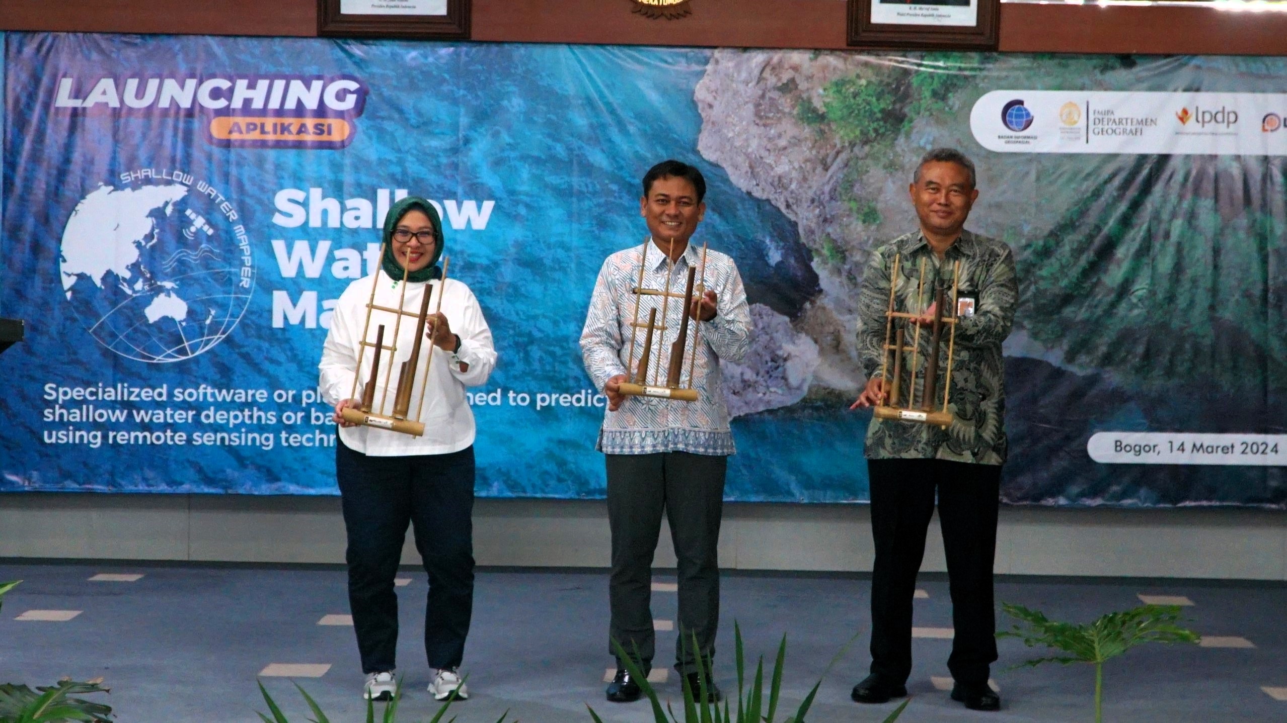
Jakarta, March 14, 2024 - The Geospatial Information Agency (BIG) in collaboration with the University of Indonesia (UI) officially launched an application named Shallow Water Mapper (SWM) at the BIG Hall Cibinong, Bogor, on Thursday morning, March 14th. This application is useful for conducting satellite-based bathymetric or underwater topography mapping.
SWM utilizes Satellite Derived Bathymetry (SDB) technology that enables efficient, fast, and accurate semi-detailed coastal or shallow sea mapping. Therefore, this innovation can break down the problems associated with the dependency on costly and time-consuming field survey activities.
The advanced features offered by SWM include direct access to satellite imagery, accurate bathymetric data extraction, and data processing using machine learning algorithms.
Claimed in its launch release, SWM marks a new era in sustainable development efforts in Indonesia through satellite bathymetry mapping technology. To learn more about and access the SWM application, visit the following link.
It's worth noting that bathymetric information or the condition of underwater topography is crucial for various fields, from coastal development, offshore areas, marine resource management, to maritime security and navigation.
The research and development of the SWM technology were directly funded by LPDP since 2020. The research proposal led by Dr. Eng. Masita Dwi Mandini Manessa S.Si., M.Si., M.Eng. from UI titled "Development of an Automated System for Shallow Water Mapping without Echo Sounding Data Based on Multispectral Image for Coral Ecosystems" successfully received research funding from LPDP through the RISPRO Competition scheme.
LPDP's Director of Research Facilitation, Wisnu Sardjono Soenarso, who attended the launch event, appreciated and supported the successful research on bathymetry mapping technology to further master national maritime.
"Bathymetric mapping is key to unveiling the vast ocean potential, coastal development planning, marine resource management which includes economic potential, maritime security and navigation, and optimal environmental protection for Indonesia," said Wisnu in his opening speech.
Meanwhile, the head of BIG, Muh Aris Marfai, in his launch speech, mentioned that by reaching Technology Readiness Level (TRL) 9, this application is ready for operational implementation by both the government and private sector.
TRL itself is a standard assessment related to the maturity or readiness of a technology outcome from research. TRL levels range from one to nine. Basic research has TRL levels 1-3, applied research has TRL levels 4-6, and development research has TRL levels 7-9.
It is expected that the launch of the SWM application by BIG and UI will be a significant step forward in geospatial and maritime management in Indonesia. The research to the product launch itself is a tangible manifestation of the government's support through LPDP's RISPRO funding towards the advancement of national science.